 Contact us: +48 608384069 | info@itsilesia.com
Contact us: +48 608384069 | info@itsilesia.com
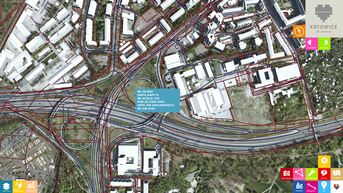
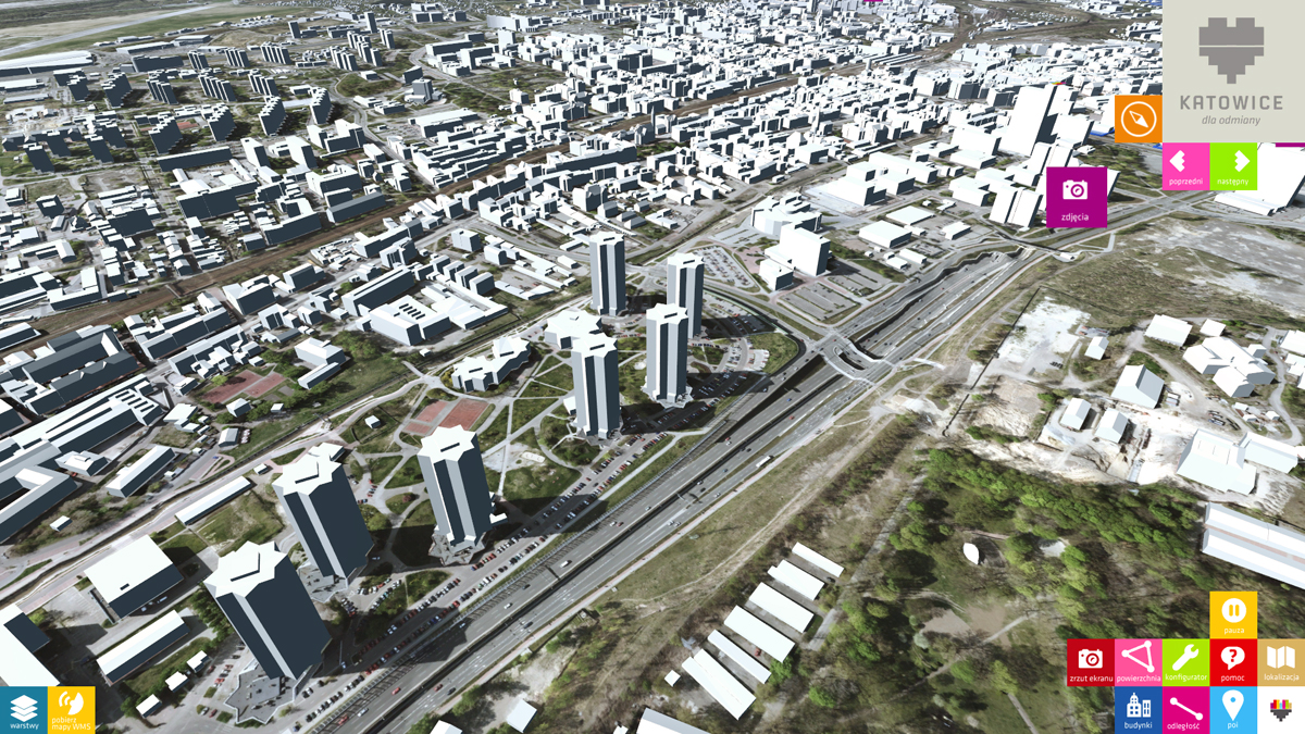
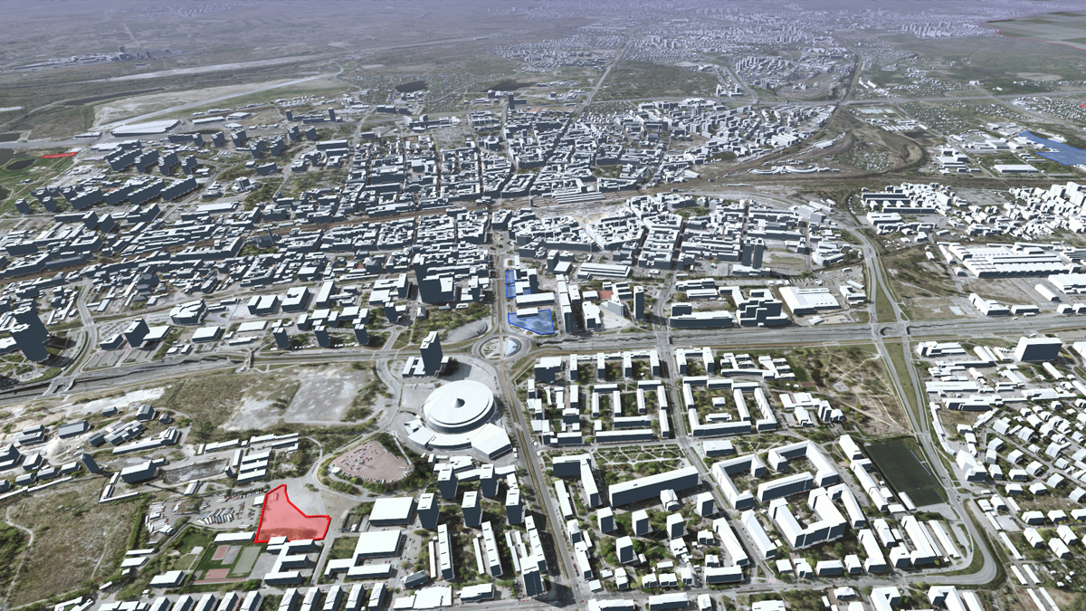
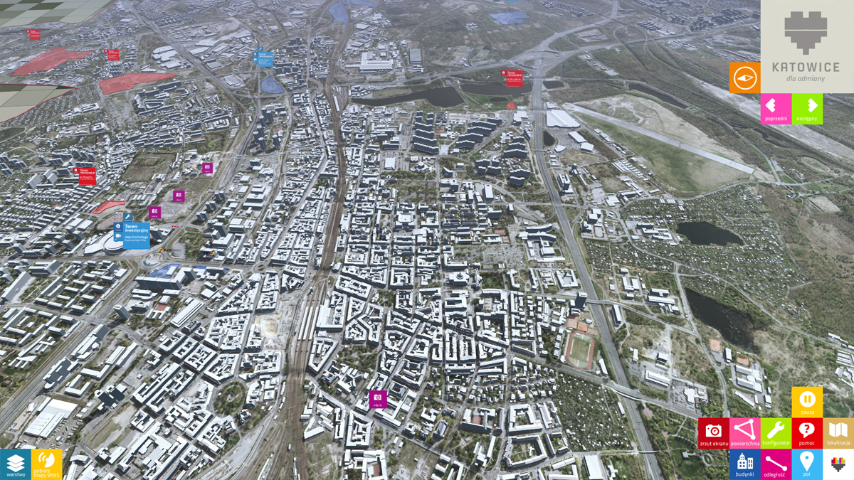
Interactive map
Katowice city
3D apps
- Client: Katowice City
- Technologies:
- Duration of project: 2 months
- Number of devs: 5
Description:
Prepared for Katowice city Council. Designed to be presented at The world’s property market in Cannes (MIPIM) and Munich (Real Expo) exhibition. Using a real time 3D engine we have created an application presenting city investment areas for sale. The application allows users to run a quick simulation of different possible development options, taking into consideration local zoning plans and other various factors like undeground infranstructure.
- individually desgined 55″ multitouch table
- virtual city map containing highly detailed terrain maps based on aerial photos
- over 200.000 buildings based on LOD2 meshes imported from GIS database
- 13 customizable investment areas, allowing users to quickly modify possible development configuration
- implemented WMS protcol for downloading and displaying additional content from external server (GIS data)